Using Drone Surveys for Materials Management Plan

The Project Team are using Drone Surveys to keep track of material movements on the 7 acre demolition and enabling works scheme.
The scheme involves large scale demolition, cut and fill exercises in areas of contaminated and non-hazardous ground on a site which shares it’s boundaries with the tidal River Avon and Bristol’s floating harbour.
The sensitivity of how material arising’s were to be handled, stored, processed and reused meant that the team had to come up with a means of tracking the material and keeping accurate records in order to satisfy the Environment Agency.
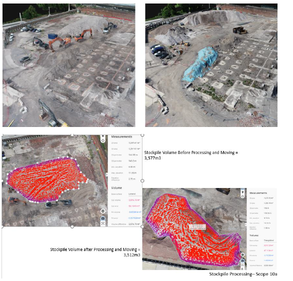
A drone is in regular use, not simply taking photos, but carrying out a point-cloud survey which enables the team to accurately measure material cuts, the position and size of the resulting stockpile, the position and size of the processed material, and finally the amount and position of the final fill.
This gives the client transparency in how the material has been used on site and an accurate record for the future development of the site. In addition, it would provide evidence that the Environmnental Agency’s MMP has been complied with and as such the proposal for it’s use was welcomed by them and enabled the recycling of 26,000m3 of material on site.
Footer Reference
Entry submitted by Kier Construction
Did you find this article helpful?
Please rate this article
 (0 votes, average: 0.00 out of 5)
You need to be a registered member to rate this.
About this entry
About the author
Daryl Parker
Site Manager
Entries by this author 1
Company Information

Kier Construction Western and Wales
http://www.kier.co.uk/
The Scheme does not promote or endorse any products, goods or services. For more information, click here.