High Density Array GPR Service ID

We encountered uncharted live pot-ended electric cables on a road junction improvement scheme. These were not recorded on the power network utility records; were not identified at design stage; were not identified by conventional GPR survey; and were not traceable by CAT and Genny survey.
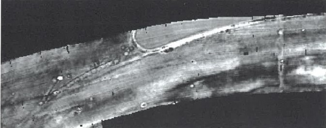
We engaged with geospatial survey specialists Macleod Simmonds who undertook a High-Density Array Ground Penetrating Radar (HDA GPR) survey of the site to locate and map buried services and structures, with a primary focus on locating pot-ended cables. The density of data collected allowed for a more accurate picture to be mapped of the sub-surface environment. While detection of pot-ended cables was not guaranteed, the survey provided additional information that together with old road designs, historic maps and utility records provided improved understanding of the sub-surface and allowed introduction of ‘intelligent’ trial holes.
Main safety benefits were:
- Reduced risk of service strikes – one of Highways England’s aspirations in the ‘Home Safe and Well’ document is to halve service strikes. The HDA GPR survey increased the understanding of the sub-surface environment, reducing, but not eliminating, risk of service strikes.
- Pot-ended cables – although not 100%, the survey provided data that could help identify pot-ended electric cables or intelligently investigate anomalies that might be pot-ended cables.
- Time and cost accuracy – data collected allowed a better understanding of underground conditions including utilities and areas of hard dig. This can inform cost estimates giving improved budget accuracy with less variation during construction stage.
Footer Reference
Entry submitted by Carnell Group
Did you find this article helpful?
Please rate this article
 (0 votes, average: 0.00 out of 5)
You need to be a registered member to rate this.
About this entry
About the author
Andrew Sharp
Managing Director
Entries by this author 35
View all entries by Andrew Sharp
Company Information
Carnell Group
https://www.carnellgroup.co.uk
The Scheme does not promote or endorse any products, goods or services. For more information, click here.