Interactive Mapping used to help with Communications

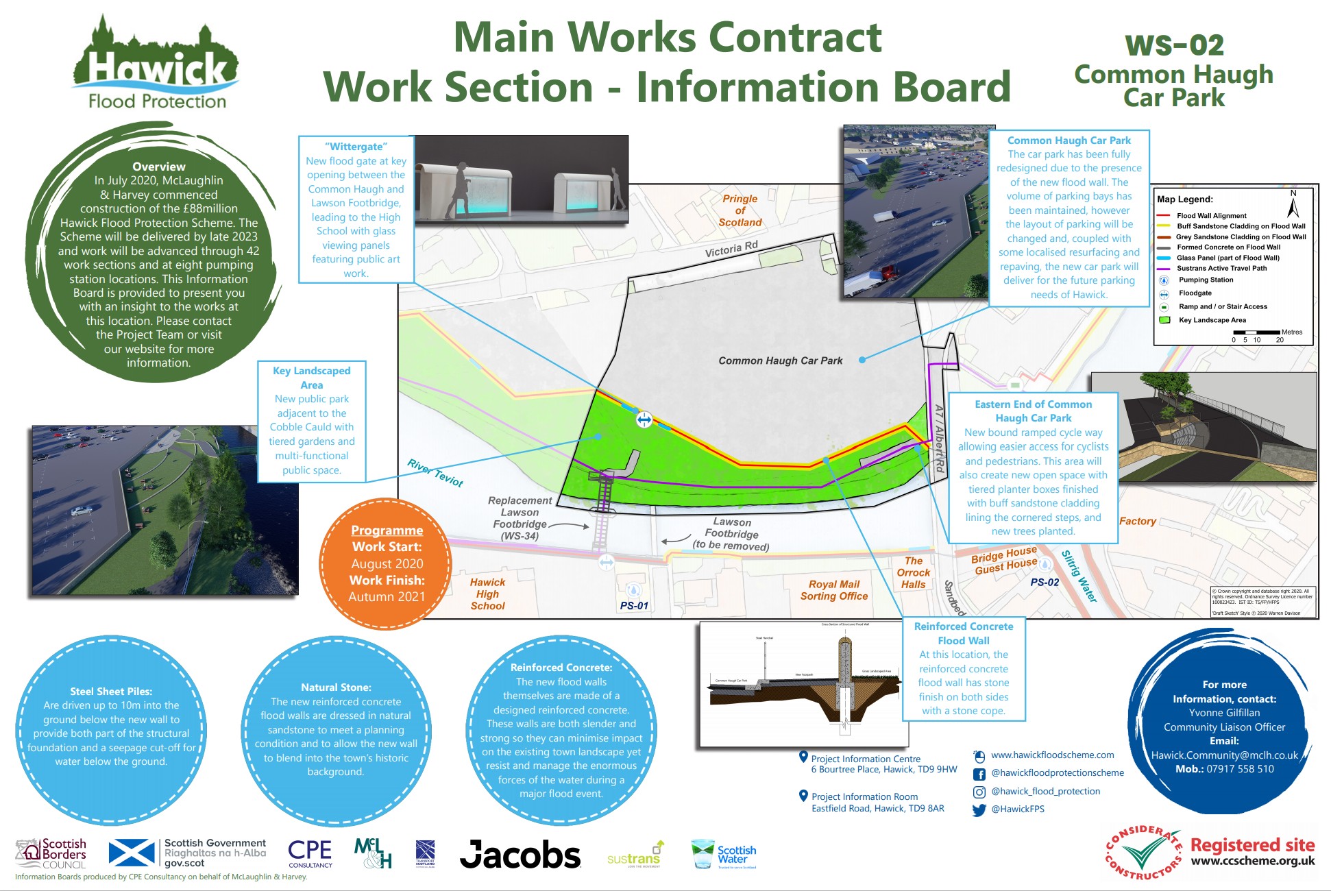
The Hawick Flood Protection Scheme is split into 42 work sections for delivery. With the River Teviot running through the town of Hawick and work ongoing with a great deal of public and site interface, the contractor has taken a proactive approach to communications and sharing information.
Given coronavirus constraints to traditional direct-facing community engagement methods, they have been striving to make the most of technology and compliment usual communication methods by adding an interactive map on the project’s website, which enables any interested party to view works in a particular work section. It is a user friendly communications tool which includes:
- Construction timeline for the works
- Nature of the works
- Futuristic view of the area
- Images of materials to be used
- Contact details for more information
- Details of HFPS funding and delivery partners as well as promoting the project as a CCS registered site.
The map will be updated as more of the design detail is confirmed but to-date feedback from the community has been positive.
Work section boards have also been erected at the respective site locations so the public can view if out and about, and these have been described as informative, interesting and colourful.
Footer Reference
Entry submitted by McLaughlin and Harvey
Did you find this article helpful?
Please rate this article
 (0 votes, average: 0.00 out of 5)
You need to be a registered member to rate this.
About this entry
About the author
Yvonne Gilfillan
Community Liaison Officer
Entries by this author 7
View all entries by Yvonne Gilfillan
Company Information
McLaughlin and Harvey Ltd
https://www.mclh.co.uk
The Scheme does not promote or endorse any products, goods or services. For more information, click here.